


Boucle dans l'Estéron

PEBREJOSIANE
User

Length
15.9 km

Max alt
1220 m

Uphill gradient
791 m
Km-Effort
26 km

Min alt
472 m

Downhill gradient
794 m
Boucle
Yes
Creation date :
2014-12-10 00:00:00.0
Updated on :
2014-12-10 00:00:00.0
5h11
Difficulty : Easy

FREE GPS app for hiking
 SityTrail
IGN / Geographical institutes
SityTrail Plus
The world is yours!
About
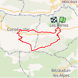
Trail Walking of 15.9 km to be discovered at Provence-Alpes-Côte d'Azur, Maritime Alps, Les Ferres. This trail is proposed by PEBREJOSIANE.
Positioning
Country:
France
Region :
Provence-Alpes-Côte d'Azur
Department/Province :
Maritime Alps
Municipality :
Les Ferres
Location:
Unknown
Start:(Dec)
Start:(UTM)
346695 ; 4856489 (32T) N.
Comments